The (so-called) Hannibal’s Wall (2650 m)
Archaeological remains in the Entremont Valley– Control of lateral access routes
Have you ever heard of the (so-called) Hannibal’s Wall?
The (so-called) Hannibal’s Wall is a Roman fortress located at an altitude of 2650 m on the eastern slopes of the Entremont Valley. It is estimated to have been built in the early Roman era, around 29 BC. More than two hundred soldiers in the service of Rome, most likely Celtic or even Germanic auxiliaries, occupied this position for at least one summer. They took advantage of its favourable topographical situation on a crossing point with a view overlooking Bourg-St-Pierre.The name “Hannibal” (Carthaginian general who crossed the Alps in 218 BC) is linked to the legend of his passage over the Great St Bernard Pass. However, we now know that he did not cross the Alps in this region!A leaflet is available at the hut welcome desk and from regional tourist offices. It can also be downloaded from www.ramha.ch (fr, de, en, it). At the archaeological site, QR codes on stone markers provide access to additional multimedia content. Other information panels can be found at the Cœur and Boveire d’en Bas alpine pasture huts in Liddes and Bourg-St-Pierre.
Access
Intermediate level hikes (T2/T3) July – September.
See here (= www.saint-bernard.ch/fr/mur-dit-d-hannibal-17879/#itineraire) for the itinerary.
On the strategic importance of pass control
Today, the Col de Mille (2471 m) is one of the easiest passes to cross between the Val d’Entremont and the Val de Bagnes. It lies just 5 km north of the (so-called) Hannibal’s Wall.
One of the most likely explanations for the presence of soldiers in the service of Rome at the site of the so-called Hannibal’s Wall is their involvement in military operations against the Salasses over 2,000 years ago. In the 1st century BC, this Celtic population occupied the Dora Baltea Valley and its side valleys (today’s Autonomous Region of Aosta Valley). The fortification of the so-called Hannibal’s Wall, defended at 360°, kept watch over the main road at the bottom of the valley and, in addition to the natural obstacles, prevented any adversary coming from the south from gaining access to the Col de Lâne (3034 m) and the Col de Mille.

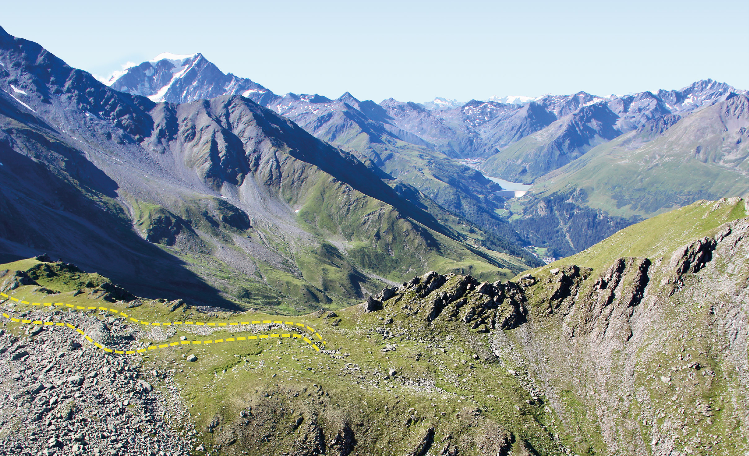
Fig. 1
Overview of the Hannibal Wall site. The remains of the wall can be seen (outlined in yellow). Its ideal location offers a direct view of the upper Entremont Valley, with the Toules dam in the background, while the ridge provides natural protection for the troops. View to the south. © RAMHA

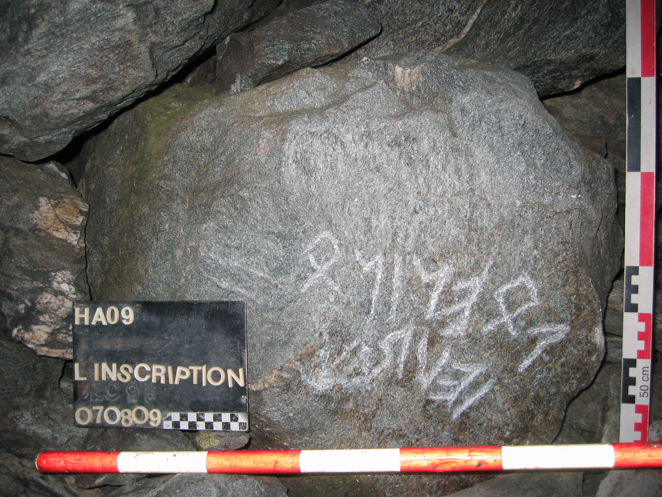
Fig. 2
Among the site’s highlights is an inscription in the North Etruscan “Lugano” alphabet, noting a Celtic language. Engraved on a slab in a shelter close to the wall, it refers to Poeninos, an Alpine god. This is one of the earliest known examples of writing in Valais! © RAMHA
Initially considered to be a single site, the Hannibal Wall turned out to be part of a probable offensive system set up by the Romans, with at least twenty positions between Valais and Valle d’Aosta.
In the 20th century: a trap-like defensive system
The presence of the Great St Bernard Pass makes the Val d’Entremont a direct gateway to Swiss territory from the south. In modern times and during the Second World War (1939-1945), the Dranse’s valleys became part of a tactical system in the shape of a trap, with an entire defence system oriented towards Italy. Among the expected defence lines imagined, the one closest to here followed the course of the Torrent de Pont-Sec towards Commeire.
Another was located at the Bourg-St-Pierre transverse valley, with the Torrent de Valsorey forming a natural water moat. Various camouflaged installations were built along the valley in the 20th century, some of them even in the alpine zone. A series of forts lined the ridge from Mont Rogneux (3083 m) to Six Blanc (2444 m). The purpose of these various high-altitude defensive positions was to ensure that no infantry forces (foot soldiers) attempted to break through the high ground towards the Val de Bagnes.
Since their demilitarization in the 1990s, some of these forts can now be visited, such as the artillery forts at Commeire and Champex.
What to see on the way to the Wall
If you follow the signposted path to the (so-called) Hannibal’s Wall, you’ll pass close to Vouardette (2462 m). On this promontory, a hut and several forts were erected during the Second World War, completing the defence line of Pont-Sec and the Col de Mille ridge. The path will then take you over the Plan Beussolet to the ridge of Hannibal’s Wall.
What did this camp look like over 2000 years ago? How have archaeologists contributed to its understanding?
Find out as you go along! Have a good hike!

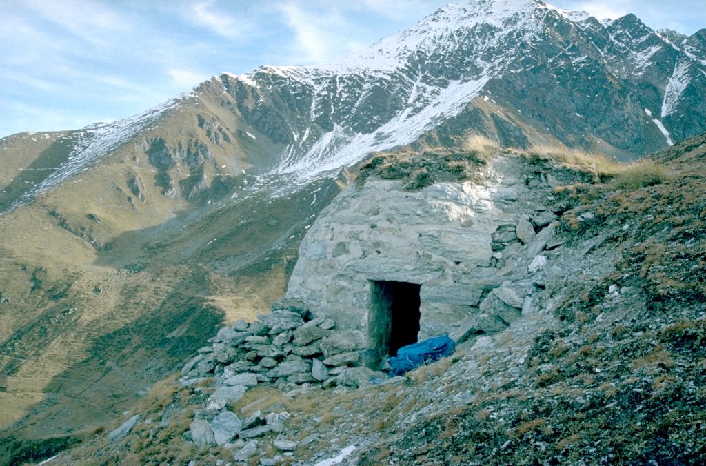
Fig. 3
An example of an early 20th-century fortification, here at La Vouardette. View to the east. © Proforteresse

Fig. 0
Evidence of human occupation in the Upper Val d’Entremont
Timeline
EASY LANGUAGE
This panel presents an archaeological site. An archaeological site is a historic place with traces of the past. These are the traces of men and women from long ago. This archaeological site is called Hannibal’s Wall. This wall served as a mountain fortress. It dates back to Roman times. From this information panel, you will need to walk at least 2 hours and 20 minutes to see the stone wall. Near the wall are the stone remains of old huts and a very old inscription. It is more than 2000 years old.
Conception and design © RAMHA, Romain Andenmatten, UNIL, Michel Aberson, ArchaeoConcept Sàrl, Leana Catalfamo
Graphics © Chab Lathion
English translation and review: Cynthia Dunning, Emma Bonvoisin
Easy to read proofreading in English © will come soon