Click here to book your package for the Grand Tour de Combins!
Stage 1 Bourg-St-Pierre -Mille hut
Bourg Saint Pierre is the most important town on the Tour des Combins. Its Saint-Charles Bridge (Charles the Great), its ancient bell tower, its Roman-era milestone and its quaint houses are well worth a visit before setting off for higher altitudes. Passing by the chapel of Our Lady of Loreto, the Creux du Mâ, Boveire d’en bas, le Coeur and Erra mountain pastures, the path goes easily via the meadows. You will revel in the astonishing views of the Entremont valley in its entirety.
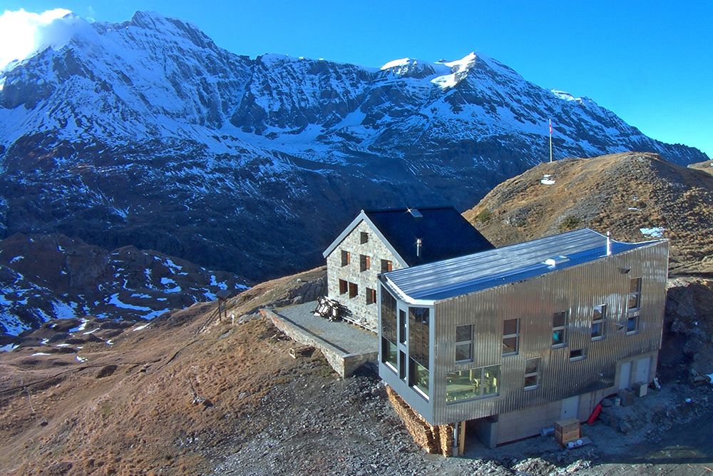
The cosy Col de Mille Hut will welcome you at the namesake col: this is a serviced hut offering 59 beds. Prepare yourselves for an enchanting panorama opening in front of you.
Elevation +1150m/-300m
Estimated time: 4.30
Distance: 12,5 km
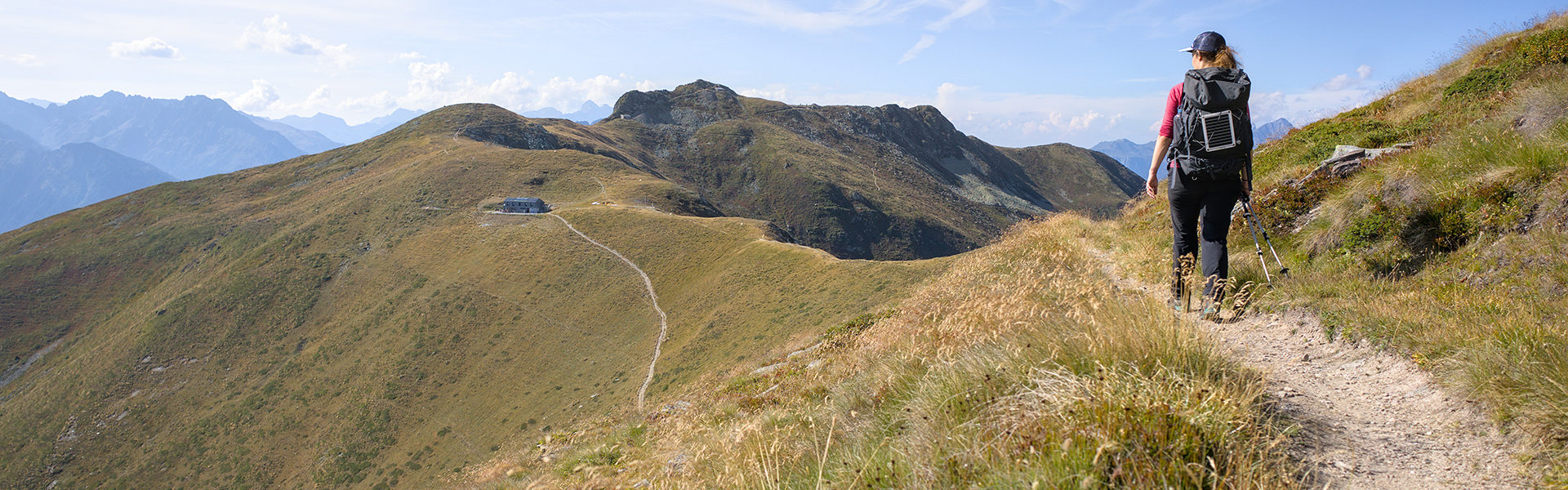
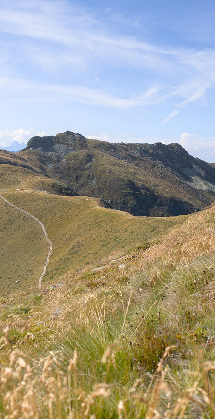
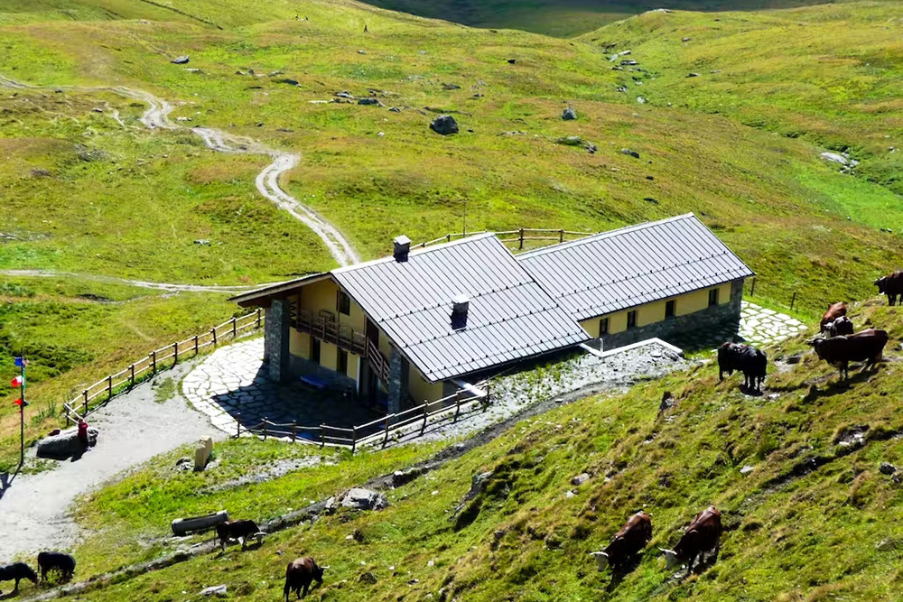
Stage 2 Mille hut – Panossière hut
Passing through the Col de Mille, you will enter the territory of the Bagnes municipality, the largest one in Switzerland (282 km²). The Tour des Combins trail gradually heads NE and then reaches la Treutse after one hour, at an altitude of 2092m. You will enjoy superb views on all the hamlets making up this municipality with a population of 7800 citizens. Heading east, the path continues via blueberries and Arolla pines and leads to the Brunet Hut.
Heading SE, the path leads to the Sery bridge set on a narrow gorge, via uphill and downhill stretches, and then reaches the “la Maye” village somewhat easily. A steep zigzag climb leads to the large, 200-metre long footbridge crossing the streams that have their sources in the Corbassière glacier. Less than an hour’s hike on an easy path will then take you to the François-Xavier Bagnoud Hut in Panossière.
Elevation +1420m/-505m
Estimated time: 5.30
Distance: 14,4 km
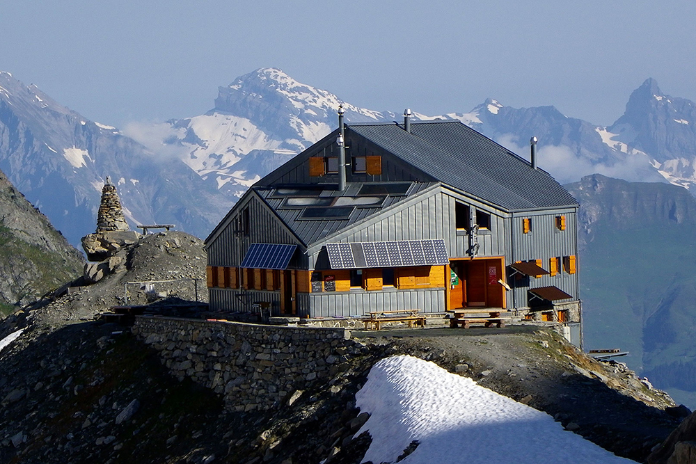
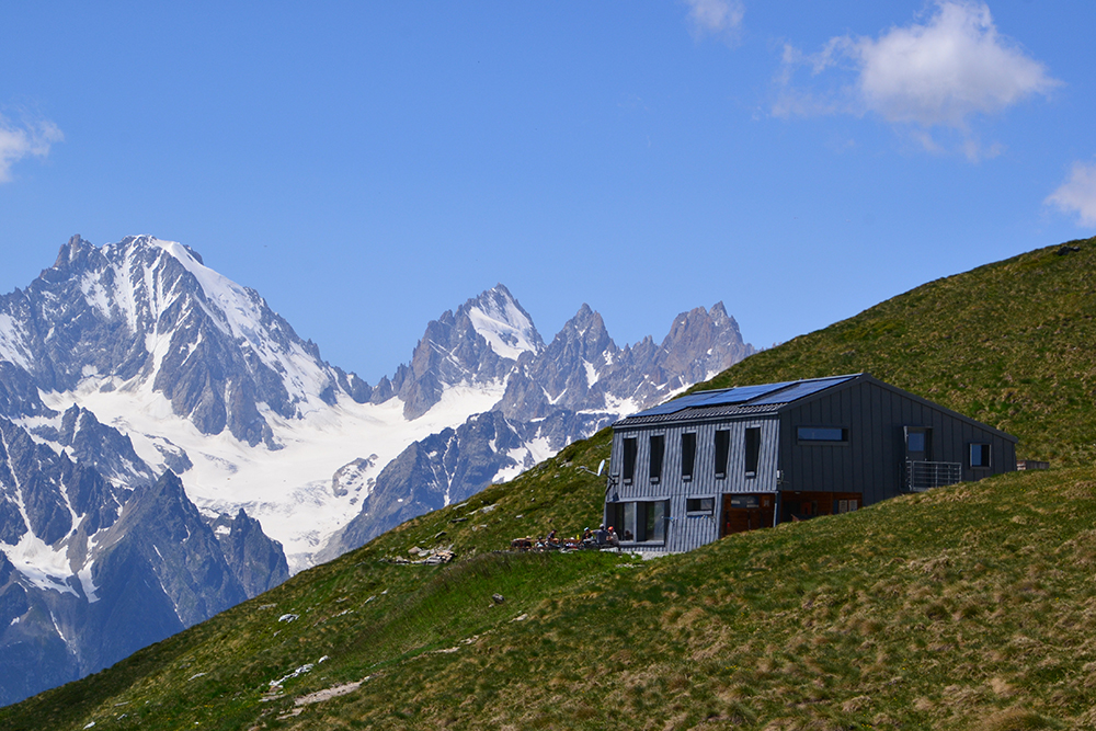
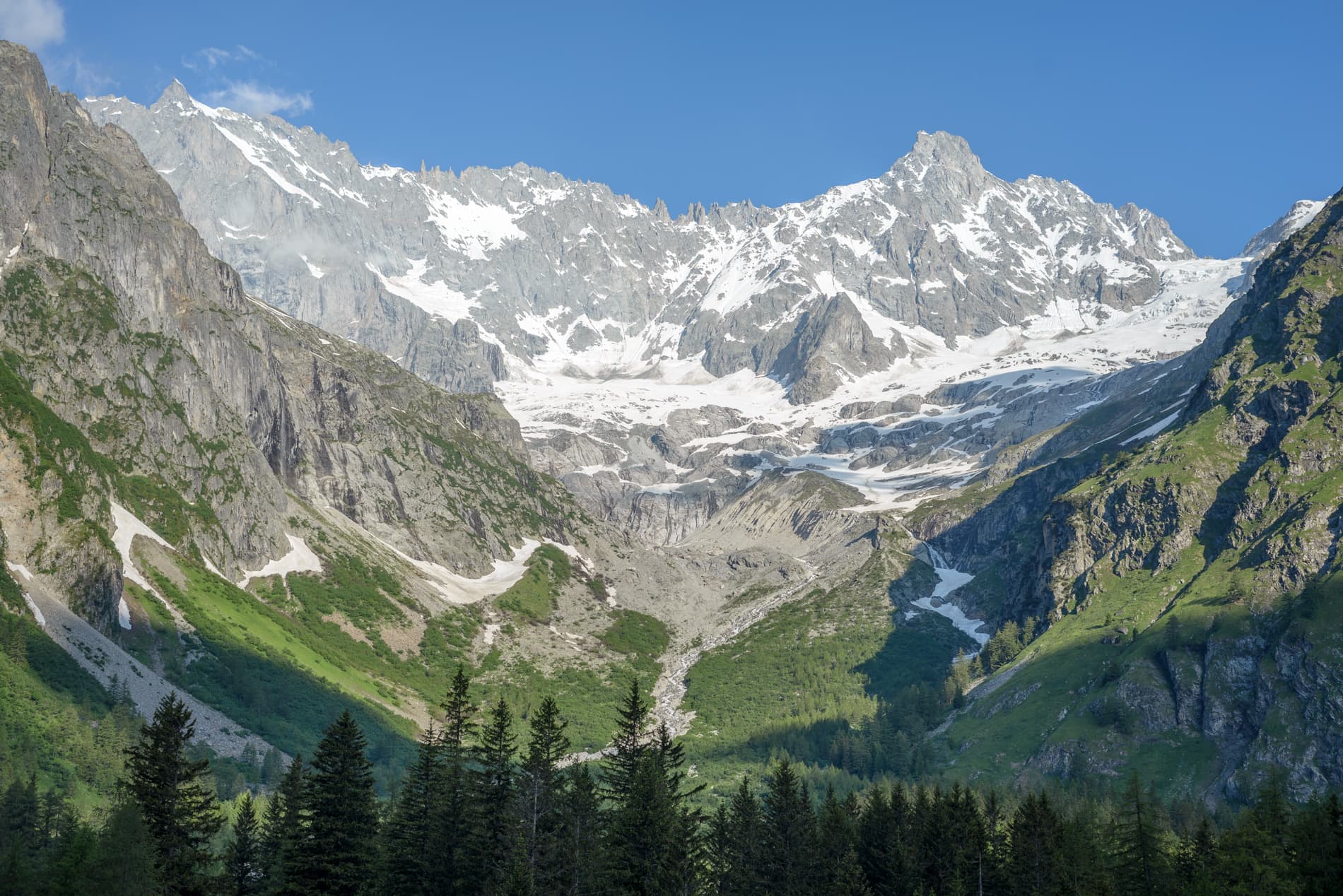
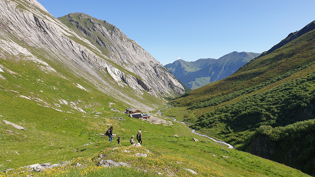
Stage 3 Panossière hut – Chanrion hut
After having flanked the moraine to the right of the glacier, the short but steep climb to the Col des Otanes starts; at an altitude of 2870m, it is the highest point on the Tour des Combins.
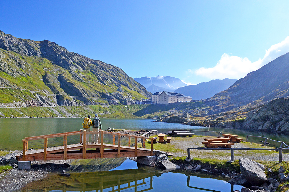
The staggering view encompasses an amphitheatre of rock and ice, where Grand Combin towers on one of the most impressive areas in the Alps. The grassy saddle of Tseumette is reached in an hour: Mont-Pleureur and the Ruinette make up the astounding panorama. In the background you will notice the imposing, 250-metre high concrete wall of the Mauvoisin dam, the highest arch dam in Europe. The descent carries on and then reaches Mauvoisin.
Following the road, you will come to the culmination of the dam that needs to be crossed to reach the right bank of the lake. Continue through a series of galleries, flanking several waterfalls and then a nice trail will lead you to the « Ecuries du Giétro » mountain pastures, listed as “historical monuments”. Cross the scenic Tsofeirë plateau and then reach the Tsofeirë col before descending to the Chanrion hut.
Elevation +1250m/-1450m
Estimated time: 7.00
Distance: 18km
Stage 4 Chanrion hut – Letey hut in Champillon
The route is somewhat visible from the Chanrion Hut and, going down gently undulating pastures you will reach the Grand Charmotane bridge, then cross it. After a decidedly steep stretch, the slope gets gentler and goes via rocky, grassy areas, then a nice path will take you to the Fenêtre de Durand. This col is where Luigi Einaudi was welcomed by Swiss soldiers back in 1943, fleeing from Fascism; after having profited from Swiss hospitality, this eminent political figure would then become the second president of the Italian Republic after the end of WW2.
From the Fenêtre de Durand, the first part of the route towards By is dominated by the austere size of Mont Gelé and the gentler shapes of Mont Avril, which make up the gateway between the Valais and the Aosta Valley. The waymarked path first crosses a stony ground and then reaches the Thoules pastures. That is where the forestry road leading to the Balme pasture and then the By Basin departs; from there, the path climbs up 150m and then reaches the Ru de By, that you should follow as far as Néan. Leave the Ru and climb to the Tsa de Champillon, then reach the Letey Hut.
Elevation +1150m/-1250m
Estimated time: 7.30
Distance: 22,7km
Stage 5 Letey hut – Saint-Rhémy
From the Letey Hut in Champillon, a steep path will lead you to the Champillon Col. The imposing trapeze of Grand Combin rises in the distance while the views encompass the Mont Blanc massif to the W. Start the descent towards the Menouve valley, as far as the Pointier pasture.
The Tour des Combins follows the path that climbs to the pasture of Combe Germain and then leads to the Eternod Stream, which you follow going west along a pretty larch forest to join up with the Barasson mountain. From here, a path will take you to the forestry road that descends to Saint-Rhémy.
Elevation +520m/-1300m
Estimated time: 5.00
Distance: 15km
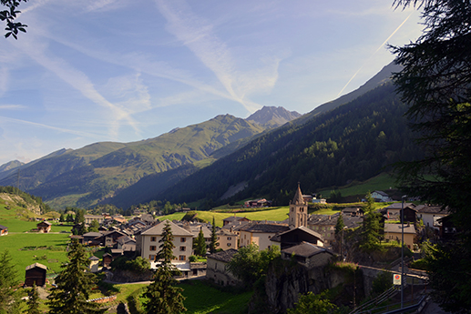
Stage 6 Saint-Rhémy – Great st.Bernard
From Saint-Rhémy, you cross the village’s main street, bordered by historic buildings. On leaving the village, a short stretch runs alongside the carriage road over the Col du Grand-Saint-Bernard to reach, on the right, the Roman road linking Aosta to Martigny. Follow this road as far as the former hospital house of the Cantine de Fonteinte. Here, the path crosses the road twice and continues through pastures. The vast amphitheatre that appears before our eyes at the foot of the Col is framed by the Pointe de Drône to the north, while to the west rises the pointed silhouette of the Pain de Sucre.
It is in this setting that we reach the Frassati refuge, an ideal place to shorten the stage. You then cross the Col des Ceingles and Col de Saint-Rhémy to join and cross the route du Grand-Saint-Bernard before climbing back up to the eponymous col.
Elevation +1881m/-1039m
Estimated time: 8h20
Distance: 20km
Stage 7 Great st.Bernard – la fouly
The stage begins at the thousand-year-old hospice, at an altitude of 2470m. First you cross the border and descend to the Baou mountain pasture.
From here, the path climbs steadily to the Fenêtre de Ferret, on the Swiss-Italian border, where the panorama is splendid. It’s then an easy descent to the Lacs de Fenêtre, where the Mont-Blanc, Grandes Jorasses and Dolent sparkle in the distance.
The route then descends more quickly to the Plan-La-Chaux and Ars mountain pastures before reaching the hamlet of Ferret. It then passes along the left bank of the River Dranse before returning to the right bank just before La Fouly.
Elevation +390m/-1260m
Estimated time: 4h
Distance: 12.6km
Stage 8 la fouly – la tsissette
The morning hike leads to the Col du Basset… a climb of almost 1200m (or 400m less with the chairlift)! Chamois, ibexes and marmots make you forget the effort and the panorama fills you with wonder…
From here, a beautiful descent awaits us to the Tsissette hut in the Combe de l’A nature reserve.
Elevation +1183m/-777m
Estimated time: 5h
Distance: 9.5km
Stage 9 la tsissette – bourg-st-pierre
From La Tsissette, you continue northwards to leave the Combe de l’A and reach the village of Drance on the banks of the River Dranse before climbing to Liddes, the main village of the municipality of the same name. The route then heads south into the valley of the Grand-Saint-Bernard, gradually climbing to Bourg-Saint-Pierre.
Elevation +426m/-817m
Estimated time: 3h40
Distance: 12.6km
Click here to book your package for the Grand Tour de Combins!
Guides
Don’t get lost and set off with the Tour’s topo-guide available on Suisse Itinérance.
To better enjoy the walk, you can also be accompanied by a mountain guide.