The (so-called) Hannibal’s Wall (2650 m)
Archaeological remains in the Entremont valley –The Combe de Boveire
| Access time remaining | Boveire d’en Bas – The (so-called) Hannibal’s Wall Approx. 1hr 20 min |
At the crossroads
Almost 450 m below the site of the (so-called) Hannibal’s Wall, you still have just over an hour’s walk to get there. The two mountain pastures, Boveire d’en Bas (2227 m) and Boveire d’en Haut (2430 m) mark out the path that now climbs through the Combe Boveire to the site of the Wall.
The layout of modern hiking routes, their signposting, the maintenance of the paths, and the installation of bridges sometimes make us forget the rugged topography of the Alpine valleys. Did the occupants of the (so-called) Hannibal’s Wall pass through here?
A guarded detour to the heights
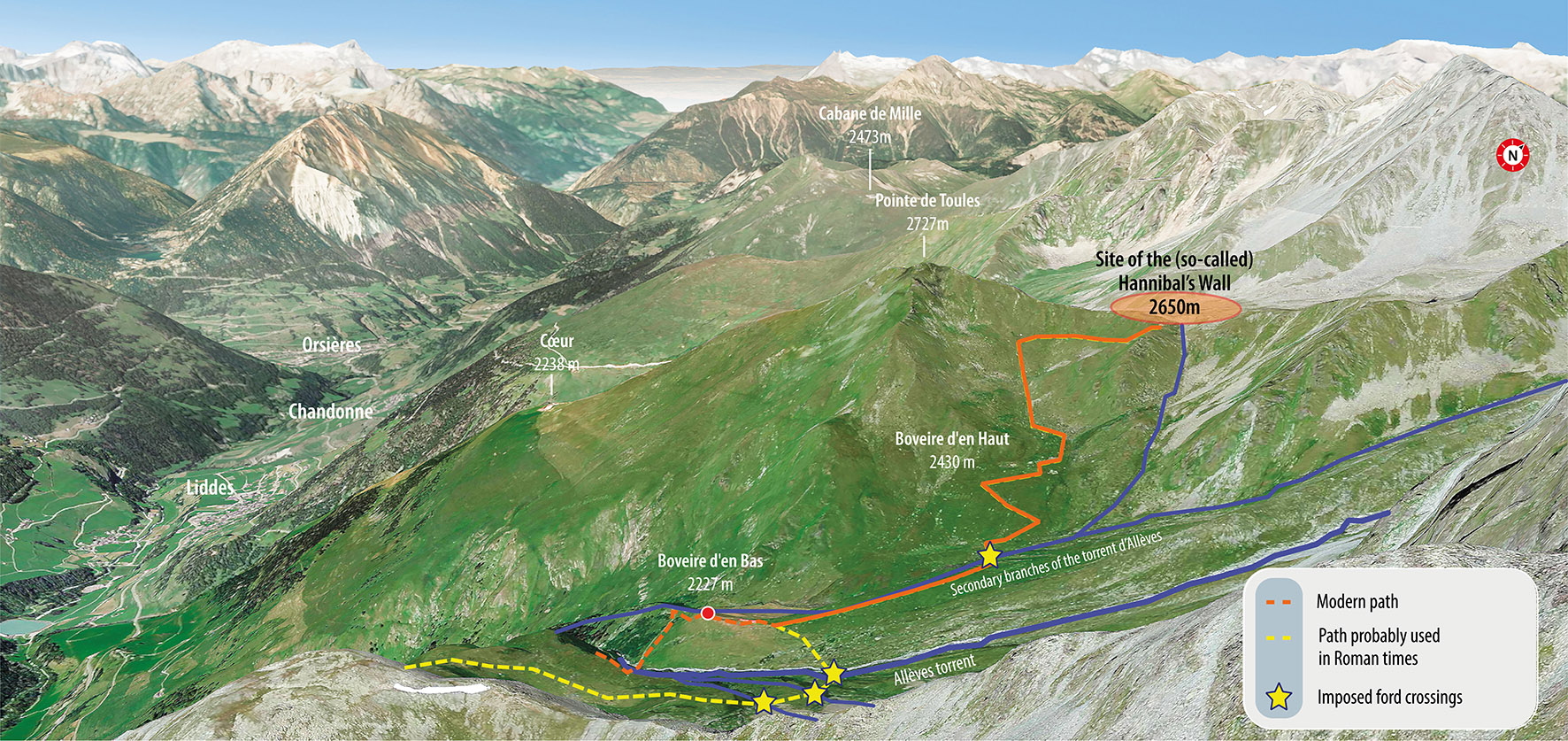
The torrent of Allèves and the gorge it has created were probably one of the most significant natural obstacles in this part of the Val d’Entremont for anyone wishing to explore it on foot. Since the many peaks and torrents act as natural obstacles, there are not many mountain trails that serve as alternatives to the routes in the plains. In the Creux de Boveire, it is possible to cross the torrent by foot, but only in certain places (marked with stars on the map).
The crossings, located above 2200 m, are partially visible from the crest of the Wall, further emphasizing the site’s strategic importance. So, if undesirable armed troops arrived on foot (infantry) from the south, the occupants of Hannibal’s Wall would not fail to see them.
The location of the fortress, therefore, reflected tactical choices in the context of territorial control, allowing observation of different routes and direct surveillance of the crossings through the Creux de Boveire.

Fig. 1 – Engl
Panoramic view of the site of Hannibal’s Wall (2650 m). Looking north. © Google Earth, RAMHA
The torrent d’Allèves
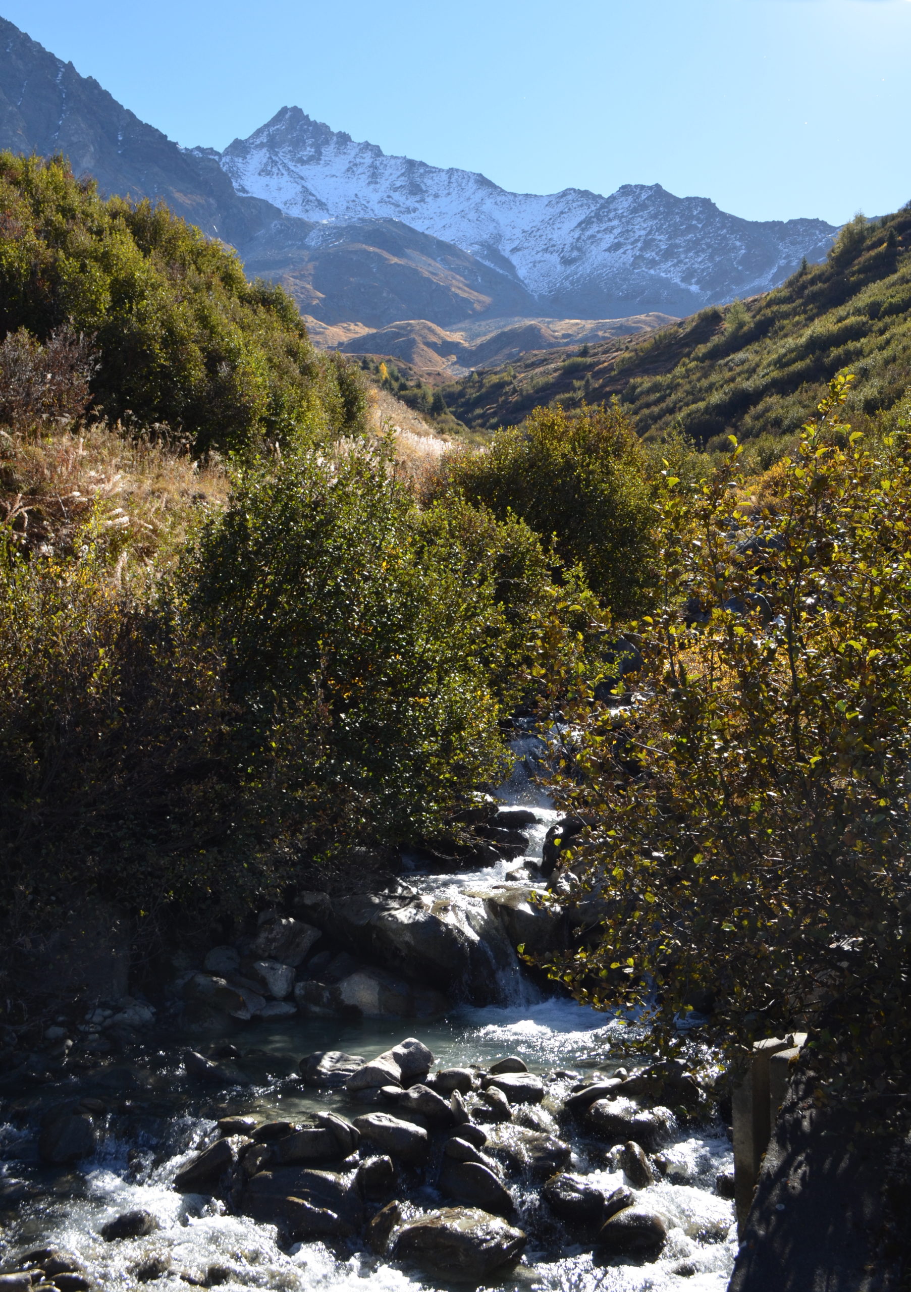
The Combe de Boveire is dominated by the Pointe de Toules (2727 m), the Petit Combin massif (3669 m), and the Bonhomme du Tsapi (2802 m). This vast plateau is criss-crossed by several torrents, which join to form the torrent d’Allèves. The torrent then continues its course through a gorge a little way downstream from where you are, flowing into the Dranse d’Entremont above Liddes. The waters of the Boveire glacier (at around 2,740 m, not visible from here) form the main source, while one of its secondary branches flows from the (so-called) Hannibal’s Wall.
Some of the water from the torrent d’Allèves is now collected below the route de Boveire and feeds the Lac des Toules dam upstream of Bourg-Saint-Pierre. The torrent is crossed by several bridges, one of which is dismantled in the autumn to prevent its destruction when the snow melts in the spring.

Fig. 2
The combe of the torrent d’Allèves in early autumn. The Ritord peak (3557 m), in the background, is already partially snow-covered. Looking east. © RAMHA
Military dress
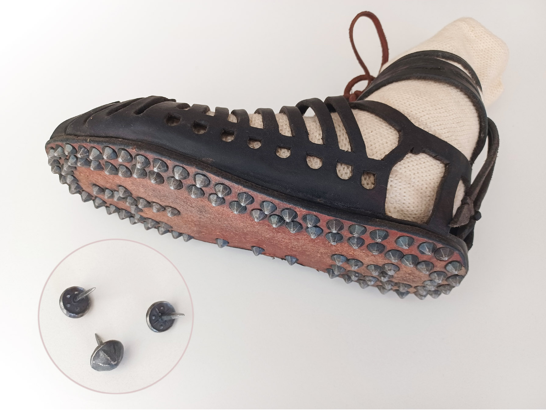
The clothing worn by soldiers who passed through here almost 2,000 years ago was very different from that worn today when crossing the Alps! Roman soldiers of the 1st century BC wore linen or woollen tunics as well as breeches and socks when necessary. In fact, the shoe could be open, shaped like a sandal, and then tied around the ankle. Nails attached to the underside of the sole ensured that the shoe adhered to the ground, rather like modern studs.
Each soldier’s weaponry varied greatly. As a rule, a soldier was equipped with a wooden shield rimmed with metal, an iron spear, a sword, and a dagger. He wore a helmet. The cuirass was designed to allow the soldier to move. The discovery of copper-alloy scales on the site of the Wall suggests that some soldiers wore a cuirass of the lorica squamata type, made of assembled scales.
The backpack was probably supported by a wooden frame that spread the load over the shoulder. It was used to carry a blanket, food, various tools, etc. Personal belongings were reduced to a strict minimum, as the soldier had to carry almost 40 kg, including his backpack and his weapons!

Fig. 3
An example of a leather caliga (open sandal) as worn by Roman soldiers. In the foreground: three shoe nails. It was not uncommon for one of them to fall out when walking long distances. © RAMHA
| On the difficulty of retracing an ancient pathOnly an informed guess can be made as to the exact path taken by the troops to reach the Wall, taking into account the topography of the terrain and various natural obstacles, such as creeks and rivers as well as the slope’s gradient and the dangers inherent of the mountainous environment, such as the risk of falling rocks. In the best of cases, archaeologists find metal objects during metal detector surveys, whose form allow for dating through known parallels elsewhere, but this remains the exception. For the Roman troops, after crossing the various torrents, the probability of an ancient access through the valley upstream of Boveire d’en Haut (where the current path is found) seems the most plausible. Please note: in the canton of Valais, as in the rest of Switzerland, the use of a metal detector without the authorisation of the competent authorities is a criminal offence. | |
| Fig. 4© Renata Martino |
It’s not far now! You’ll soon be up there!
As you continue towards the Creux de Boveire, you’ll once again be following in the footsteps of the Wall’s former occupants. When you reach the ridge, you’ll find a map of the site and the chance to find out more about life at this altitude in the past, thanks to stone markers giving access to online information (QR code), which you can also discover here (= www.saint-bernard.ch/en/the-so-called-hannibals-wall-17882/#inscription).
EASY LANGUAGE
Welcome to Boveire! There is a bridge below to cross the torrent d’Allèves. A torrent is a mountain stream. The Romans came up here over 2000 years ago. But this bridge did not exist then and the torrent was difficult to cross. To get here, the Romans may have crossed the river higher up because the torrent splits into several smaller streams which can be crossed without a bridge. The path then leads to the (so-called) Hannibal’s Wall. From there, the Romans had a very good view of the valley.
Conception and design © RAMHA, Romain Andenmatten, UNIL, Michel Aberson, ArchaeoConcept Sàrl, Leana Catalfamo
Graphics © Chab Lathion
Drawing © Renata Martino
English translation and review: Cynthia Dunning, Emma Bonvoisin
Easy to read proofreading in English © will come soon